 |
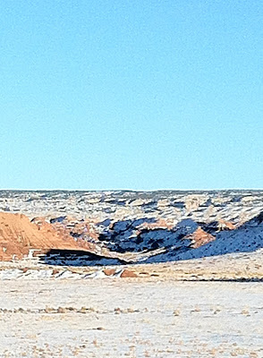
| A typical gorge type canyon in the San Rafael. |
Located primarily in Emery County, Utah the San Rafael Swell is traversed by Interstate 70 from Salina, Utah on the west to Green River, Utah on the east.
The area has had many special proposals to preserve it including the making of a national park.
Anasazi and Fremont Indians lived in this are from 3,000 to 600 years ago at various times. These tribes were hunter gatherer and agricultural based tribes. Many of their villages, pueblos, and grave sites mark the area where these civilizations thrived. Indians left petroglyphs and pictographs behind on the stone cliffs as to their day to day life stories.
Later when white settlers came the Spanish used the area as part of the Old Spanish Trail for trading and exploring. Other whites came through to explore such as John Wesley Powell on the Green and Colorado Rivers. The Mormons after several unsuccessful attempts settled the area from 1870s through 1900.
Outlaws such as Butch Cassidy and the Sundance Kid used the canyons as hideouts from the law due to the mazes and labrynths of canyons were a natural obstacle to any law enforcement. The Mormon Settlers established towns such as Richfield, Salina, Castle Dale, Emery, and Green River as farming and ranching communities. The desert terrain was good for running cattle due to high plateaus that had numerous natural pastures in the Spring and Summer. Cattle rustlers also used this land to steal and conceal bovine quarry.
 |
| This vast expanse is traversed by many slot canyons which can be deceiving to the unprepared hiker. |
Winters are often at freezing or below in the higher elevations during the day time and the valleys are in the 30s and 40s Fahrenheit. At night winters can be below freezing in the valleys and colder in the highlands.
Buttes, mesas, hoodoos, arches, free standing rocks, rock fins and other strange formations are concentrated more here than many areas of the Colorado Plateau due to the folding action of the earth's crust.
Much of the San Rafael can be viewed by driving Interstate 70 from east to west or vice versa. The rest is accessed by dirt road, OHV, horseback or hiking. Due to the deceptive terrain and numerous slot canyons it is wise to know your route and prepare for the unexpected if going into the deep back country. Typical animal life is that of the west including desert bighorn sheep, pronghorn, deer, cougar, and bison to name a few.
There is much debate over natural resource development vs leaving the San Rafael as it is. As such it appears a multiple use land policy will need to arise with stakeholders of all sorts giving up something in order to utilize the rich energy and the scenic wilderness that is the San Rafael Swell.
nothing like a good slot canyon, I have a few on my itinerary this year. I also poked my finger on a yucca on the gray cliffs high above gateway canyon yesterday, it was quite exhilarating, I even let a few drops of Shon blood trickle down on it 'now be gone little yucca' the Shon has spoken.
ReplyDeletewww.weloveshon.com