Saturday, July 31, 2010

If Interstate Travel Bores You Things To Do While Crossing The Desert

Driving across the vast expanses of America can be very uneventful. In the Midwest and West you can go for miles and get nothing but tumbleweeds and sagebrush. So here are some helpful tips while crossing the vast expanses of land from sea to shining sea.

Always take advantage of increased speed limits.  Most states in the west have 75 MPH speeds, except Oregon, which is stuck at a maximum speed of 65 MPH. So decrease those vast expanses by taking advantage of the interstate travel speeds and rural highway speeds.  Always watch for the law and drive safely.

Notice the landscape. This is Blue Mountain in eastern Utah near Vernal. The Western US is full of varied landforms from the Rocky Mountains to bizarre landmarks. This can break up the time so you don't fall asleep at the wheel or redirect your "are we there yet" children by showing them the beauty and diversity of the geographic features while heading to Disneyland or Sea World.

Driving along the edge of a cliff will always take away boredom. Fear of falling is something we are all born with so why not use it to our advantage.  If you are afraid of falling off of a cliff like this winding road through Colorado National Monument, you will stay awake or others in the car will insist you pull over and let anyone, including the baby take the wheel so you don't plunge to your death.  Also spectacular views should keep anyone awake just for the beauty of the trip.

If you must drive across northern or central Nevada may I suggest night. Day driving can cause drowsiness even for the most experienced drivers.  US Highway 50 is the "Loneliest Road in America" for a good reason. I have seen the miles of sagebrush and junipers mile after mile in the day. A night drive and a chance encounter with alien life forms may be more to your liking. Let the night do it's magic of hiding boredom while you quickly cross the vast expanses of the Great Basin.

Summer is fire season. Why let a good bushfire go to waste if you are driving by.  Lots of other rubberneckers will also be paying attention. The fire with its large flames, the choking smoke, the planes dropping large amounts of fire retardant on the blaze all make for good learning and lessons of nature. Just don't put yourself in danger by being a gomer and getting yourself into a situation where you could become a victim of said blaze and be injured or killed.  Point out to the kiddies that when you smoke and chuck that butt into dry grass this is what might happen and the authorities may stick you with the bill for being a dumb ass for starting the fire.

Oil is the life blood of America. These big oil well pumps have always amazed me the way they pump out crude out of the ground. This one is at the foot of the Uinta Mountains in Utah. But they are all over the West and Southwest if you know where to look such as Colorado, Texas, Oklahoma, New Mexico, Utah, Arizona and even the liberal bastion of California.  For fun if you have an environmentalist wacko in your car stop on the side of the road next to the beast and just count the up and down movement of the pump. Preach about drill baby drill until they strip naked and run into the desert seeking a hippie colony to feel safe with.

If you are a fan of canyons and rivers may I recommend Hells Canyon on the Idaho-Oregon border. This geologic wonder of river erosion through rock to make canyons. Hells Canyon lives up to its name. Very hot in the summer and freezing cold in the winter. Hell is a furnace and also freezes over.  The Snake River is a great place to take that break to stretch as you take out your map to find out where the wrong turn was or why your GPS isn't working.

In the west Utah deserts as with other places of the west the monotony of boredom can set in quickly. Thus point out that you are confused as are these mountains. The Confusion Range in Juab and Millard Counties in Utah will confuse you if you get off the road. Some of the mountains appear to have been broken off and only half remain.  Shield volcanoes also litter this area for hundreds of miles north to south. So stay on the main road unless you know how to be confused.

When in doubt of where you are going consult the Ancients. Their highly visible images just might break up that long drive across the desert. This place called Newspaper Rock in southeast Utah will tell you about who invented the wheel, find game, plant corn, and where to hide if neighboring tribes come to kill you. Though the Anasazi have moved on they left this map for our generation so that long after they had gone to the Great Spirit, you could have their wisdom on your journey.

Tuesday, July 27, 2010

Ye Olde Prickly Pear


One type of cactus you can always count on is the Prickly Pear whether you like them or not. They come in all sizes from the flat pads, spines, small glochids, itchy to downright painful.  Prickly pears always are around.

From the Opuntia family these cacti are found in all the major North American deserts.  The Great Basin is North America's largest desert. And one of the few species of cacti that live there are the opuntia polycantha.

This lovely cold hardy cacti was one I encountered as a young boy in Sandy, Utah along the mountain foothills. I ran into a giant colony of them and screamed all the way home. Now I raise them, how irony changes a hate to a love.

Lewis and Clark as they came across the continent noted that the prickly pears were everywhere and they had to watch out carefully or they would step in them. The thorns went through their moccasins (OUCH!) and were a constant nuisance.

The one thing you can count on with prickly pears though is that they flower. In fact all cacti are flowering plants.  Prickly pear have a variety of blooms from crimson red, to pink, to orange, to white, and hybrids of the above. This specimen was taken at the Idaho Arboretum in Boise.  One last flower before the summer fireworks were over for the year.  Just how big can a colony get? Well that varies. I have seen them as high as six feet and wide as ten feet.  They propagate by sexual reproduction, the flower, and thus fruit and seeds, and by dropping pads. A disconnected pad will take root and start a clone of the parent plants.

I am not sure if prickly pear or any other cacti for that matter send out rhizomes, so help me out here in the comments section if you have an idea.

I can only imagine Lewis and Clark and the Corps of Discovery encountering colonies like this mile after mile. This type of large colony is not unusual in the wild if the plants are in the right area for sun, moisture, and nutrients.  They love well drained soil and that is where you will find almost all species of the prickly pear.

The last photo is from the Colorado on the Colorado Plateau. This bunch was on a cactus Wikipedia page about cacti for awhile. And then the anal retentives decided that their pics were better than mine. But this batch has made it back because the blog belongs to Dave, yours truly and Kirk the other guy who occasionally posts here. So here I will round out my blog on prickly pears for this cactus episode.  Maybe next time I will blog about Home Depot cacti, but then maybe I wont.

Tuesday, July 20, 2010

Craters of the Moon


In southeastern Idaho on the Snake River Plain is a large lava field and old volcanoes, Craters of the Moon National Monument.  In the distance is an eroded shield volcano. These volcanoes do not get as high as other volcanoes as the lava is near the surface and it does not have to force its way up the way that larger mountainous volcanoes such as Mount Rainer or Mount Vesuvius. The cones are much shorter and wide and the craters are smaller.

The name comes from the fact that it reminded some people of the landscape of the lunar surface.  The volcanoes and lava flows have been dormant now for about 2,000 years or so.  The area is still geologically active and part of the Yellowstone volcanic system.

The lava field is truly a unique formation. On the right is a picture of  one of many cravasses some of which extend just a few to hundreds of feet deep.


As lava flows and cools it produces cracked flats like this one pictured on the left. These fields can be wide open or short plateaus that abruptly end in lava tubes, hills broken up, or caves.


This lava mound is a twisted and contorted cracked mound. The mound shows how the lava cooled. You can see the markings of the lava when it was free flowing. Cracks and odd shapes make each of these mounds into unique natural rock sculpture.

The trees and shrubs find a niche in small openings such as the one featured on the right. Lava rock is highly rich in minerals and in soil form is known for its great crop growing from potatoes to vineyards. Many plants take advantage of these rocks for the same reasons.

To the left is a lava cave that opens at the top and descends downward. As the crust on top of the rock thins over time it eventually caves in on itself. This probably was originally a lava tube or tunnel underneath the rock before becoming this crater seen here.

To the right is a lava bridge. This thin area of pooled lava covers a crack beneath it. Going over this one was a bit tricky as I tested the weight of the rock beneath my feet. On all lava fields testing the crust is important as one can fall in to a hole or crack if they are not careful about moving around on the flow.
Finally you can see the expanse of the lava flow with the mountains in the distant background. The flow once on it seemed to go for miles and miles. The entire Snake River Plane was formed by the very forces that made Craters of the Moon National Monument. It is that other world experience without having to leave earth to see it. And unlike the moon, the lava flow supports and abundance of plant and animal life. On our way out from this trip we encountered a rattle snake. The snake is a great reminder to be careful whenever hiking in the wilderness.

Monday, July 12, 2010

Great Basin Summer


It is July here at the eastern edge of the Great Basin and the foot of the Wasatch Range of the Rocky Mountains.  Typically at this time of year from late June through August temperatures range in the 90 degree Farenheit range with about one to two weeks in the 100+ degree range possible.


Now sometimes I think of the Great Basin as a very boring type of desert.  The standard shrub is the sage brush. And mile after mile of the stuff can be very boring.  However there are some very pretty areas of this large basin if you know where to look.

At the northern end of the Great Basin is the Snake River Plain a large volcanic field with fertile soils that streches from Yellowstone National Park on the east to Oregon on the west. The above picture is a sunset near Ontario, Oregon.


While making a brief trip to Wyoming before the Independence Day weekend I took a shot of the new Welcome to Utah sign. Nice to see that the state finally has the idea that the 2002 Winter Olympics in Salt Lake City are finally done. The old signs depicting the games were up far too long. Looking across through the sign you can see the typical high basin and range topography that the Great Basin is famous for along with the endless sage.


This photo shot near my home is one of those "get that shot" moments. We get thunderstorms that come in the afternoon. This sunset just happened on the tail end of one of them. This is over Lehi, Utah.


I am not quite sure what type of flowers these are but they stand out against the brownish clay ground cover.

This is another typical Great Basin Shot. Across the sage and salt brush you can see green junipers covering the higher foothill. These junipers are the primary conifer over most of the basin and range desert.

A pair of small daisies growing up near a rock covered with lichens.

Opuntia polycantha or the Great Basin Prickly Pear flowering amongst the rocks and sage.


Fish Springs National Wildlife Refuge in western Juab County, Great Salt Lake Desert, Utah.

Mountain stream near Sundance, Utah.

Thistles can look pretty with their white flowers. Don't touch and I would not recommend for landscaping.

The Wasatch Range looking east from Eagle Mountain, Utah.

Sclerocactus glaucus in bloom.

Dry Creek in Highland, Utah. Not quite so dry as this is right before rain and high tempratures caused the creek to overflow its banks. Dry Creek orginates in Alpine, Utah in the Wasatch Range and empties into Utah Lake.

This is Utah Lake with the snow capped Wasatch Range in the background. As late as June the mountains are still capped with snow that will run off well into July before the highest peaks at 12,000 feet are completely snow free. Utah Lake is one of three large lakes in Utah left behind by ancient Lake Bonneville 10 to 15 thousand years ago.

The Great Basin for its size has many interesting areas to visit. It has one National Park, Great Basin National Park, extinct volcanic fields scattered across the eastern and central desert, caves, and sand dunes are all found within the Great Basin geographical area.  Late spring and early summer the desert comes to life only to become dry and brownish again by August.  

Deserts truly are magnificent places. Beauty can be found if only one looks beyond the dryness and heat to see what life makes its home in such a challenging environment.

Thursday, July 8, 2010

Great Engineering Feats of the Desert


One of the things I love about America's deserts is man's ability to build engineering marvels in some of the most inhospitable land that allow for people to live in greater numbers than they otherwise could.  To the left is the Glen Canyon Dam Bridge near Page, Arizona.

This bridge made a trip across the gorge a quick jaunt where absent the bridge hundreds of miles would have to traveled to get from one side to another.

Glenn Canyon Dam itself is a marvel of American ingenuity also. The Dam impounds Lake Powell just inside Arizona and back up into Utah. The Dam provides for flood control and hydroelectric power on the Colorado River.

Route 66 the fabled transcontinental highway prior to the Interstate system is another great feat. This famous highway stretched from Chicago, Illinois to Los Angeles, California.  It made the road trip famous.  Here part of Route 66 is still in use today at Gallup, New Mexico.


To the right is the causeway across the Great Salt Lake connecting Antelope Island State Park with Syracuse, Utah. Seven miles of raised earth make this  access possible and makes a remote island in the middle of a dead sea accessible to the public. In the picture you are looking from Antelope Island east across the Great Salt Lake.


Hoover Dam on the Nevada-Arizona state line was once the largest dam ever built. It still remains one of the largest in the world.  Built during the height of the Great Depression, the dam impounds Lake Mead, provides water for irrigation, generates power for Las Vegas, Los Angeles, and Phoenix.

Lake Mead also provides a great recreation area in the middle of the otherwise hot and dusty Mojave. A new bridge at the top of Black Canyon will soon replace the highway that tops the Dam. Hoover Dam is a great working structure and a marvel of modern engineering.

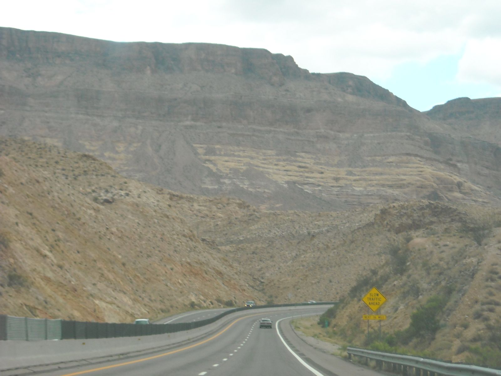
Interstate 15 through the Virgin River Gorge in Arizona was one of the most expensive highway projects in U.S. history.  Blasted through the winding canyon and crossing the Virgin River several times it is a wonder that this stretch of highway was ever built. Before its completion to get to Las Vegas, Nevada from St. George, Utah required a trip directly west about 10 miles and then on a two lane highway over a mountain pass down to Littlefield, Arizona. The I-15 project took an hour off the drive to Las Vegas to Salt Lake each way.

One of my favorite bridges is the Freedom Bridge over Starvation Reservoir in Utah. This one mile stretch of US 40 is not the greatest engineering feats, but it is in a difficult area of the Colorado Plateau. Starvation Reservoir in the eastern part of Utah is a smaller reservoir created by the Strawberry River. The picture to the right is a winter shot of Freedom Bridge in the winter.  Duchesne is 10 miles to the east and Heber City is 40 miles northwest.

Modern engineering has made living in a desert, which I do possible in all aspects of life. Sometime appreciating a desert is being thankful for the man made things as well as the beauty of nature.

Tuesday, July 6, 2010

Use Of Tropical Plants In Healing

At American Fork Hospital in Utah there is a unique kind of garden that comes out each year. It is known as the "Healing Garden." The various types of plants they use you would not typically find in Utah let alone in most of the State. Above is a banana plant and quite large for a greenhouse special.

The use of palms and tropical yucca are beautiful. If this was not a hospital you could convince me this is anywhere in Mexico, Central America, or Hawaii.


Of course one of my favorite things to do is to just sit and listen to a waterfall. They are quite relaxing. I suppose they have the same type of attitude at the Healing Garden. I think it is great when a hospital can take care to put out so many beautiful plants and just for a moment give people a chance to take their minds off their health problems, work, or other concerns. Kudos to the gardener and landscaping teams at American Fork Hospital for this summer mini tropical paradise.

Saturday, July 3, 2010

Hands Off The Yucca, Succa!

Y. filimentosa or Adams Needle is common here in Utah and now is the time for these lovely blooms to come out. Adam's Needle is from the eastern United States, but does well out here in the Great Basin Environment as well as the South and Atlantic regions of the United States which are definetly more humid.

Some of these yucca have grown in mounds in the gardener's planting areas. They are common in landscaping here and I assume other areas. They are very cold hardy yucca and tolerate drought conditions as well as wet conditions.

The latter does not mean overwater though.

My second is called a Red Yucca, but it is not a true yucca. It is actually called hesperaloe parviflora var. parviflora. Like true yucca it is in the agave family. My plant that bloomed this year is actually not the best plant. It has been on the cusp each winter, but bounces back. So I put up the picture so that I could show this little "yucca" that could.

Cultivation of yucca is rather less complicated than other types of plants. They largley require little maintenance, many are cold hardy, and they have longevity on their sides.  A good thing to remember is that all desert or drought tolerant plants need some type of fertilizer and regular watering.

During the high summer I water the yuccas that I have weekly to semi weekly depending on temprature. As always use well drained soils to prevent root rot. If you have clay soils, then a mix of clay, sand, and rock type soils will take care of water retention problems and help prevent root rot.

I am not a plant professional, nor play one on TV. But advice is free and if I can lend some experience in yucca care I am willing to do so for the three people that have visited my site. Have a great Independence Day if you are in America, otherwise enjoy the weekend.

Cactus Ring

Powered by WebRing.